travel

The Amerindian and the Miner

[Note: I wrote this piece in 2002 soon after starting to advise the Guyana Gold & Diamond Miners Association on ways to improve the environmental credentials in the backdam]

He may be a miner, but he’s Amerindian too.

And he may be Amerindian, but he’s a miner as well, and like all miners he had to understand the new environmental regulations: no more discharging of tailings directly in the creeks and rivers and no more hydraulic mining.

Guyana, the Land of Many Waters, has plenty of water to use for removing the tonnes and tonnes of overburden (up to 3 metres in depth in places) that covers the precious placer gold and diamond in the alluvial flats, river banks and channel beds. It also has plenty of bodies of water into which the tonnes and tonnes of fine slurry of silt and clay laden tailings can be dumped with seeming impunity.

It is the Amerindian people of Guyana that are the first to feel the negative environmental and health impacts of these widespread practices. Whole riverine communities (and in this tropical country they all are riverine) are affected and they can’t drink the muddy waters, which also contain potentially lethal quantities of bio-accumulated mercury (used to attract the gold particles out of the slurry through the formation of amalgam). The fish are poisoned and certain species are disappearing.

But mining must and does go on. Precious metals form the basis of our technologically and industrially based society, and gold and diamonds, while also possessing strange non-industrial properties to some human beings, are part of Global Village Inc’s rapacious diet.

So why mine if you’re Amerindian? Simple…if you don’t cash in on this hidden income, then chances are the Government’s going to let someone else make money from it. But it’s not that simple either. Government legislation has connived to make mining to the Amerindian people of Guyana a bitter-sweet prospect. Unlike all other miners, Amerindians who mine gold and diamond deposits found on their tribal lands (and this is a contentious issue in itself as there is preciously little demarcated native title in this country, after the British left saying that much more should be handed back) are free from the payment of royalties to the Governement of Guyana (GOG).

Some Amerindians make the connection, but not all: that at the current rate and the current state of zero environmental regulation (Note: there are now new laws coming in the Mining Act and the new EPA Act and the newly established EPA agency have umbrella jurisdiction too, but the policing in such remote and wild locations is a logistic impediment) mining is bad for their health, livelihood and sacred lands. But for a people caught between cultures, the westernised-globalised one based on the consumption of imported good and services forces them to see mining as a ready-made solution. What’s more it’s a form of employment and income, which unlike other forms of income, doesn’t require that they migrate to the semi-urban coastal conglomeration that is home for the overwhelming majority of Guyana’s ever-dwindling tiny population of 698,000.

Information and studies on environmental impacts of mining have been made. Last year I met Amerindians on the Middle-Mazaruni who still didn’t know where the results were for the hair samples they’d surrendered to an internationally-funded mercury study. This information, there if you ask for it, shows about 10% of the population with body mercury levels above the WHO safety thresholds of 5ppm.

After over two years in this South American country, that’s neither Latin American nor truly Caribbean, my work in the interior has been based on relationships, relationships with the people, with the miners, with the land, with the coast and with the economy. And dealing with miners, they told me as I started this new job (a consultancy with the GGDMA), was crucial to the success of the project. The Government of Guyana wanted the rivers clean but their impetus for change was internationally driven. Attractive re-financing of foreign debts (something Guyana may disappear off the face of the planet because of, especially if its remaining population all depart for the extra-territorial precincts of NYC and Toronto) comes at a price: the increased production of cheap exports for sale on foreign markets. But these exports, bringing precious foreign exchange earnings in a IMF structurally-adjusted Guyana, also need to be seen to be human-rights friendly and environmentally-friendly commodities. And so the sudden interest in environmental remedial works in the backdam (a general term for the areas, agricultural or bushland, away from the populated Atlantic coastal margin) seems to have been driven by this motivation. The GGDMA were forced to dance to the GOG’s demands and external funding was called into drive the new tailings management project.

Land dredging or low-tech hydraulic placer gold mining may become a thing of the past in Guyana as it has just about become everywhere else. The fact that Brazilians, Venezuelans, even medium-scale Australian operators have flocked to the lawless jungles of the interior of Guyana is because they can continue a low-cost (but commensurately low profit) form of mining that had since become outlawed in their own respective countries. In those countries mechanisation toward dry mining was enforced: it increased the profit margins, which was good for a government eager to realistically cash in on a previously hard to regulate industry of small, transient, unorganised miners – pork knockers as they romantically call them in Guyana, mechanised fossickers as you may find them called elsewhere) – and at the same time addressed all important environmental standards. Less tailings were produced and with increased mechanisation, rivers and creeks could be effectively isolated from mine operations with process water being regulated and contained for settlement on site.

In dealing with the government, the miners and the Amerindian communities, I soon became aware of the monumental leaps required to achieve this utopia.

So what of the Amerindian miner?

Categories: travel | Tags: , , , , , | Leave a comment

Where the Black Water Runs Clear

[Note: I wrote this in Guyana in 2002 while working for the Guyanese Geology & Mines Commission on a Canadian-funded project as environmental advisor]

Carefully I navigate my teeth, gums and jaws around the wonderfully aromatic curried powis (a large clumsy canopy-dwelling bird, sort of a cross between a bush turkey and a buzzard), ever mindful of the sharp and jagged shattered bones, hollow and tubular, that have already punctured my gums in places. As camp cook, this is Snowy’s early morning revelry, afforded by the fortuitous passing of an Amerindian hunter, keen to offload his avian prey plucked from the rainforest canopy for some cash. As we devour his bush kitchen creation, prepared in the Guyanese way with deft blows from the cutlass and an ample portion of East Indian spicy curry, Snowy is philosophising in his uniquely Rastafarian way about our good fortune and what the universe may be attempting to say to us all. Snowy, a strange name for a man whose skin shines sheer ebony, works alongside his lithe and able-bodied assistant, Rastaman (Troy). They are both wary of our team’s waning enthusiasm for the continued fare of baked camp-oven bread and salt-fish curry. Fresh meat is on everyone’s mind.

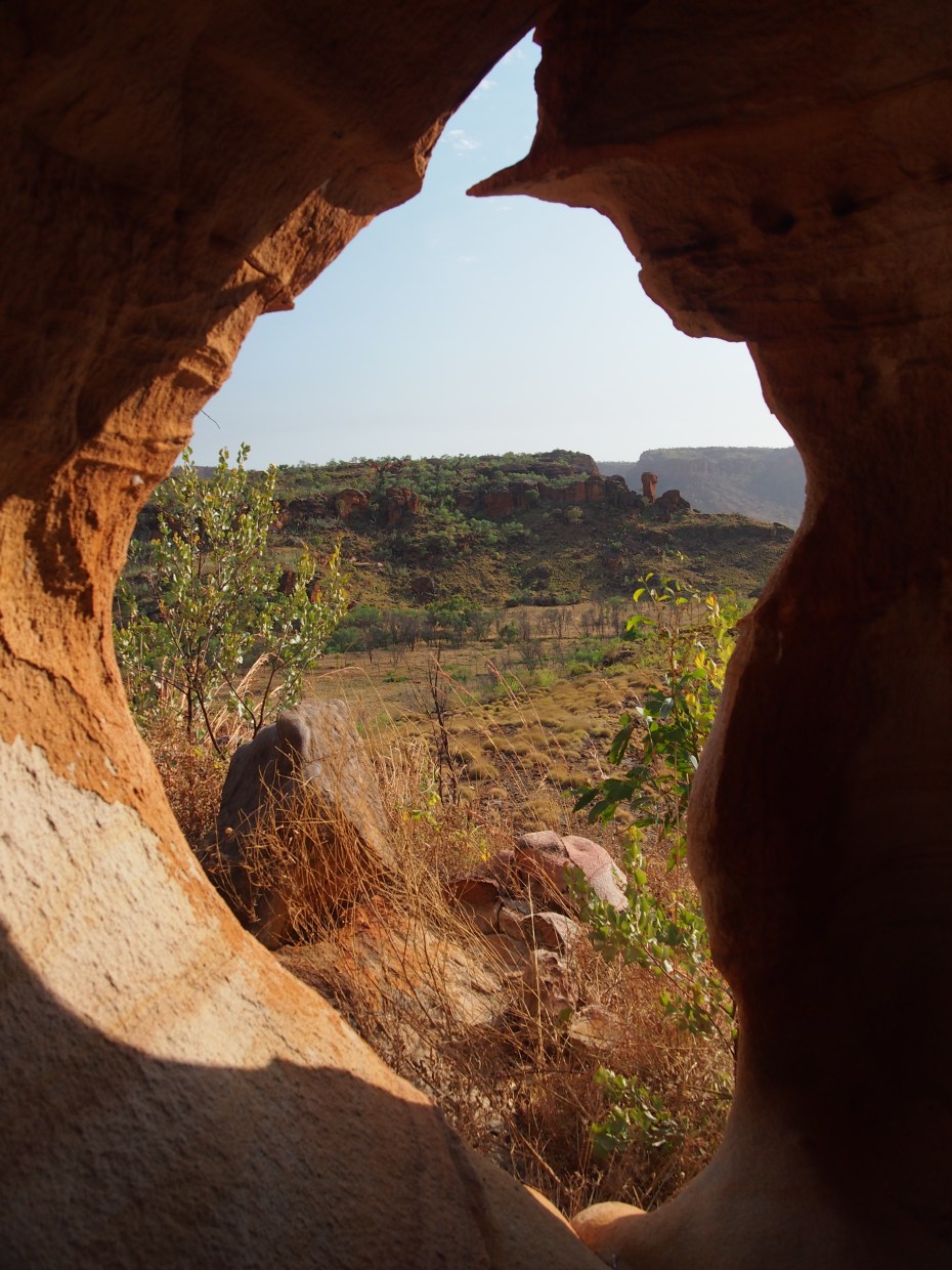
Our jungle camp is the field outpost for the Guyana Geology & Mines Commission (GGMC) in the remote North-West District (NWD). The disputed border with neighbouring Venezuela lies nearby to the west. The Barima River, upon whose steep banks we are perched, starts its journey in Venezuela then winds its way through this undulating limestone lowland jungle, before crossing back again and discharging eventually into the Orinoco Delta. Not far from here just a few hours away is the site of the infamous Jonestown, virtually indistinguishable now from the surrounding jungle, where in 1979 were found the remains of American cult leader Jim Jones and over 900 of his followers, supposedly victims of a mass suicide. But for my Guyanese colleagues this bizarre historical event is furthest from their minds.

Our outpost is nothing more than a series of huge canvas and nylon tarpaulins stretched across an A-frame structure made from bush poles. Beneath this we hang our hammocks and take refuge from the daily downpours. As environmental mining consultant to the Government of Guyana (GOG) and the Guyana Gold & Diamond Miners Association (GGDMA) I am based out of these illustrious digs for several weeks at a time. My colleagues on this project are just two of the handful of mining engineers in the country. Our task as mandated by the GGMC Commissioner is to address the negative environmental impacts from the placer (alluvial) gold and diamond mining in these remote locations. We’re two days by Atlantic ferry and inland river speedboat from the coastal capital of Georgetown. But once you’re here there are muddy roads to travel. Four-wheel drive vehicles, their trays overladen with cheering miners, heavy dredging pumps, PVC pipes, barrels of diesel and female sex workers, roar past our camp between the inland river town of Port Kaituma and the various mining camps, or backdams as they call them in Guyana.

The bush meat devoured Terry, the staff driver, resumes his awkward position under the four-wheel drive, greasy hands tinkering above him. He’s mumbling to himself about how he gets neither support, parts nor time to maintain this our only work vehicle. With mining camps springing up all over the place as people claim to have hit new placer deposits in the buried gravels, our environmental extension activities demand constant travel between shouts, as the gold-fever affected miners call these new claims, and this affords no down time for the ailing Hilux Dualcab utility. But Terry is a relentless man.

Our departure this morning has been delayed by six hours as Terry strained and sweated rivers to repair CV joints, steering rods and sagging suspension leafs. This hurry-up and wait scenario is well known in these parts and taking advantage of the situation Snowy was able to prepare us the tasty meal of curried powis before our delayed departure for the backdam. I decide to sneak in some hand washing down by the cool and crystal clear brook, tinted with the tannins oozing from the jungle floor. In Guyana they call this blackwater and it has a national reverence and supposed magical qualities: it is said that if you drink the blackwater and eat the labba (a diurnally active jungle floor-dwelling rodent, the smaller cousin of the largest rodent of them all the capybara, and a highly prized bush meat) then you’re bound to return to Guyana forever. Escaping into the jungle out of the harsh heat of our camp clearing is a welcome relief and I am joined at the favoured washing spot by the women from a small Amerindian community nearby. They laugh at the white man doing his own washing, as they beat and slap their mens’ clothes upon the moss-covered rocks into bucolic obedience: a state resembling cleanliness. However, I’m more at odds with another dilemma: an environmentalist adding to the steady inflow of detergents and phosphates into these pristine streams, these revered blackwaters.

Yet is the blackwater really revered? The miners are dumping tonnes upon tonnes of tailings into these rivers, and not far from the one that I now lie immersed in they have turned them from blackwater to milk chocolate, killing biological activity through sheer sediment load and the bio-accumulation of mercury. The Amerindians complain to the Ministry of Amerindian Affairs because they can’t drink the water or safely eat the fish (unbeknown to many of them and according to a WWF-funded national study done three years ago, yet withheld from effective publication by the GOG, they have levels of mercury in their hair above safe international thresholds). The Minister for Amerindian Affairs, recently occupied for the first time by an Amerindian and a woman at that, complains to the Minister for Mines (who’s also the Prime Minister), who in turn complains to the Commissioner of GGMC, who thus assembles his office-bound managers, gives them a good rap over the knuckles and says were going on a field trip.

The midday sun is now burning my white white skin as I continue to hurry-up and wait with my Afro-Guyanese colleagues. Looking as roadworthy as can be, bound with wire and odds and ends, the Hilux is now ready to meet the fact-finding entourage of the Commissioner and his managers. Travelling by light plane from Georgetown to Port Kaituma and then by four-wheel drive out to the camp, they arrive visibly shaken and thankfully late just as Terry makes the final adjustments. Terry looks as seriously run down as the vehicle: he’s suffering a relapse of malaria, something very common in these parts and which I would later feel the full life-threatening effects of myself. The rest of us fresh from morning bathes and tropical idleness, rally ourselves into activity, as the Commissioner makes a cursory tour of the jungle camp and staff quarters. Apart from the blood stained dirt floor, which Snowy spilt during his earnest preparation of the wild bird curry, the camp looks good, but the Commissioner is upset: there is no pot of coffee or cool drink for his entourage and he publicly berates poor Snowy for his lapse of duty. We all feel for him as we’re grateful for his culinary efforts just sampled, but we remain silent. The Commissioner is a commanding figure and the source of his real frustration is neither the paupered state of his NWD outpost, nor the fact that he’s just endured a back-breaking jolting ride from Port Kaituma, but more to do with the socio-environmental business at stake in the backdams. His message to the miners will be black and white and we’re all heading out to Eyelash, the name of the backdam with the worst environmental impact in the NWD, to accompany him on this important mission. Eyelash backdam is three hours drive, yet only thirty kilometres away over terrible mud-soaked roads. With the midday heat now pushing thirty eight degrees Celsius and the humidity at around ninety percent we set off, Commissioner in the front with a rapidly deteriorating Terry at the helm, his managers in the back seat and the field staff, including my two mine engineer colleagues, all crammed into the open tray. Today everyone seems intent on avoiding the wrath of the Commissioner.

Coming into any backdam in Guyana’s remote and underdeveloped hinterland is a culture shock. In many cases the number of Brazilian and Venezuelan miners is double the number of Guyanese. They have the capital and the technology to invest in a country which until now never had any environmental regulations. In Brazil and Venezuela, both geographic neighbours to Guyana, the government shut down the small-scale mining industry: too hard to regulate and extract royalties, and too hard to minimise the widespread environmental impacts. So the miners just picked up their equipment and moved over the border. Many Guyanese resent this influx, others see it as an opportunity to invest and learn.

But this is about to change, and in more ways than one. Guyana the last country in South America to adopt national protected areas legislation is also on a path to regulate the environmental impact caused by the mining industry. Big mines have had their share of criticism in Guyana in the past: after the huge and catastrophic cyanide spill into the Essequibo River (Guyana’s largest river) in the mid-nineties by Canadian transnational gold mine Omai, the large gold, diamond and bauxite mines have tightened up their act with huge dams now mandatorily holding all wastewater and tailings on site, and in Omai’s case, still only a few hundred metres from the Essequibo banks. It is the small-scale miner with almost zero collateral that is now the challenge for environmental regulation.

The small-scale miner, or pork-knocker as they romantically call themselves, is able to penetrate deep into the jungles, by boat and then on foot, and so the task of ensuring that all production is declared to the Guyana Gold Board for collection of royalties is a logistical nightmare for an under-staffed and under-resourced public service. In addition to this small but significant on-going loss of revenue is the inability to police the fledgling environmental regulations that specify that tailings must not be ejected directly into any drainage line, backswamp, stream or river, and that tailings dams must be constructed for the purpose of containment, settlement, and ultimately the discharge of cleaner water. Guyana is mindful of their resource (they don’t call it the Land of Many Waters for nothing) and as an interim measure the government has set the maximum turbidity limit for mine discharge water at 30 NTU (a unit of turbidity, where 10 NTU is the reading from one of those still surviving unpolluted blackwater creeks). However, most of the receiving waters in Guyana’s backdams are well over 1000 NTU, some peak at the 5000 NTU mark, while other near solid creeks are simply off the scale!

Working against plans to regulate this elusive industry is the fact that the Guyanese pork-knocker is essentially a subsistence miner, who knows of no other form of income generation. Close down the backdam as the Commissioner has alluded to and Guyana faces a social backlash: armed with the guns they use to defend their claims in the backdam, the miners may well converge on Georgetown, the small urban capital, already rocked daily by months of political instability and delinquent crime that some say is politically-sponsored. Murder and assassination are a daily occurrence and the tabloid press have pages devoted to the latest carnage.

Having arrived in Eyelash and secured the use of one of the local bush camp rum shops, the Commissioner orders for miners to be assembled in a hastily organised public meeting. The drone of hundreds of diesel generators is drowned by the melodic blasts of Brazilian forró music and the competing reggae and hip-hop favoured by the locals, as we go around inviting those not out on the claims to come and join the forum. Men are either resting in hammocks or drinking in the bars if not out dredging the overburden in the creeks. It’s like a frontier town: sleazy bars and restaurants strung along the single, mud road, a legacy carved out by the now defunct Barama logging company ten years previously. We manage to get together about thirty miners; nearly all are Afro-Guyanese. The Commissioner starts his diatribe.

“What we have here in Eyelash gentlemen, as in many other backdams across this country, is an ecological disaster. One that must be stopped!”

His words devolve into platitudes about how they must work better from now on. By the looks on these guys’ faces I can see that their reality will not bring fruition to the suggestions being made today. Our message is: recycle dirty water, build tailings dams, plan your operations. But these pork-knockers don’t have the money or the means to invest in machinery to build such structures, let alone the know-how to implement the planning necessary to bring change. Neither do the government’s mines officers in the field. Many of the Brazilians however, do have excavators and some environmental know-how gained from their experiences with legislators back home, yet in this frontier environment where visits from officials are seldom, they rarely bother when they know they can all get away with it.

The Commissioner’s visit is intended to warn the miners of a brave new future. Now his presentation has moved on to the risks of HIV infection and the prevalence of violence in the backdam, some directed against women and sex workers. The executive secretary of the Guyana Gold & Diamond Miners Association adds his comments to those of the Commissioner. He has little respect in these parts as the members of the GGDMA are mainly the big money men working larger mechanised operations away from these lawless backdams: the pork-knockers’ gripe is that the big money men always manage to get the Government to support their claims for tax breaks and concessions.

Weeks later I would return to Georgetown for my reporting duties with project managers and debriefings with government ministers. I would also meet with my friend, the Brazilian Ambassador to Guyana and he would have some news for me. In recent months the tide of Brazilian miners staking their fortunes in Guyana has turned. Recent rumours in the context of the newly elected government of Brazil of a re-opening of the small placer gold and diamond mining industry have started to lure Brazilian miners back home. Previously used as a scapegoat by the GOG complaining of lost royalty revenue escaping the country through illegal Brazilian miners, the government is now alarmed at the prospect of a local small-scale mining industry without the technological and informal financial backing of these Brazilian operators. And as a sign that other international trends are placing the GOG under further stress, the Prime Minister, with the portfolio for mining, in an address to industry regulators, miners and stakeholders, announced that just as international embargos on the so called ‘conflict diamonds’ in Liberia and Sierra Leone have reduced foreign incomes for those impoverished nations, the potential embargo of non-environmentally friendly produced gold and diamond could affect Guyana’s foreign revenue in the future. The clean up must go on.

After the meeting and his warnings made, the Commissioner wants to take a walk into the backdam, and my fellow colleagues the mine engineers and I oblige, leading the Commissioner through vast clearings where gallery rainforest stood before, around dredge pits and milk chocolate coloured ponds. The surrounding emerald forest begins to cast long shadows but the sun still has plenty of bite left as we stand around and see the all too familiar mining activities churning gravel and overburden into slurry. We even see the occasional miner washing down his sluice box mats adding mercury directly to them: a dangerous and illegal practice. As I’ve witnessed on previous occasions I imagine the miner later that night putting the amalgam (the heavy combination of mercury and the attracted gold) into a sardine tin and placing it on top of the camp fire. The mercury will burn off as vapour leaving him to claim his little chunk of gold from the tin. The mercury vapour falls as it cools and contaminates the soil, the bush camp tables and the uncovered food. It also falls on the miners themselves. The GGMC has produced leaflets about the use of retorts and have even begun distributing low-cost versions amongst Amerindian miners, a group least able to access this health conscious hardware. But in all my travels I have never once seen a retort, let alone one being used to burn off and recycle mercury.

“Where is the original creek line?”, queries a perspiring Commissioner. “This is it!”, we respond, “You’re standing in it.” Mining practices have dredged all the channels in search of the placer gold and diamond (alluvial deposits in buried sand and gravel). The creek is a series of filthy ponds and abandoned dredge pits strewn with giant buttress tree roots and enormous burnt trunks, unfathomable in size and leaning dangerously over the dwarfed miners below, busy blasting away the overburden with water canons.

Satisfied that his managers have seen the reality, the Commissioner orders the return to camp. Terry is unable to drive. All afternoon he’s been suffering an intolerable cold sweat as the malaria fever takes hold of his shuddering body. It’s time for a now compassionate Commissioner to take the wheel, while poor Terry bobs and sways with the rest of us in the back of the Hilux tray for the return journey to camp. He’s in a bad way and there’s no treatment out here, but within a few days Terry would be fine: after all he is still a relentless man.

Back at camp the Commissioner berates his managers for not having attended to the living conditions of us staff in the field. There is talk of proper buildings with gauze netting on windows to provide decent quarters and office space, which would allow mines officers to undertake their arduous paperwork in the cool of the evening in a mosquito-free environment. But this is pie in the sky stuff. Bizarrely though the visiting entourage from head office have left us a porcelain toilet fixture. They say that it will be installed soon, but this is not a priority, well at least not for Terry shuddering in his cot behind us.

That night Snowy, illiterate, asks me to read him some of the newspaper. We have a new one, only four days old, which the recently departed head office entourage has graciously left behind. It is rare to get news in these jungle locations, and a Georgetown paper is a prized possession. The Guyana Chronicle talks of the latest wave of drive-by killings. This time it is of someone we all know: the wife of one of our geologists, shot dead in a neighbourhood rum shop in the capital. The bandits were targeting Guyana’s Public Prosecutor as he sat with his Justice Ministry colleagues. They wounded him but killed a number of innocent bystanders. The dead woman’s husband is away on a geo-exploration survey, way up in the next river system, far away from our camp and out of radio contact. We soon learn via the bush telegraph, over the departmental HF radio frequencies that a GGMC team has been sent in to find him and pass on the terrible news. That night swaying in our hammocks in a late cool breeze, mosquitoes buzzing just beyond the nets that enshroud each of us, we silently contemplate our battles. I am full of remorse for our geologist colleague and he doesn’t even know what happened yet. The symphony of frogs, crickets and the faint flutter of small insectivorous bats hunting inside our bush camp, lulls me to rest. But I’m mindful too that some bats are of the blood-sucking variety. Settling down for the night I curl my body inwards away from the edges of my mosquito net.

The remainder of the camp crew stagger in from their nightly torchlight bathes down by the creek and ready themselves for bed. I hear some laughing and references to the latest disappointing performances from the West Indies World Cup team: being Australian there’s always a lively debate when it comes to cricket. Snowy lights the oil lantern, a nightly ritual that I suspect has something more to do than just keeping a light on for those night-time toilet walks. As he tumbles back into the adjacent hammock I listen to his final Rastafarian philosophy for the day. I can sense that he’s just glad he doesn’t have to live in Georgetown and I guess that he’s sort of right when he surmises that it’s safer out here in the bush.

The black howler monkeys start up in the distance, their powerful roar barely audible, and I’m left pondering Snowy’s comments. Guyana’s hinterland is home to Amerindians, miners and misfits. If the backdam is going to be a safer place for all, then the blackwater must remain black, the labba must remain free from mercury and the pork-knocker must be capable of adopting the brave new world of environmental mining techniques. In this perfect world Amerindian tribes, with 14,000 years of ancestry on these lands, may then, too, have a say in their future. Or are these late night mental images just the beginnings of a rising malarial fever affecting my better judgement?

Categories: travel | Tags: , , , , , | Leave a comment

The Land of Many Waters

[Note: I wrote this in Guyana in 2001 while working for Youth Challenge Guyana]

Guyana, on the northern Atlantic coast of the South American continent, has long considered itself part of the Caribbean community. On March 19 2001 this nation of less than one million people goes to the polls to elect a new President. Chris Curnow[1] focusing on the country’s northwest region, observes an indigenous movement that hopes to enshrine traditional ownership in the country’s laws. While the various political parties wage their campaigns on issues affecting the non-indigenous majority, the Amerindian Peoples of Guyana continue to focus their struggle on land rights.

Spend a week on the rivers, everglades and wetlands of Guyana’s north-west and you’ll find yourself in deep water, in a wet land beset by a noble struggle for recognition and land rights. The struggle may escape the casual sojourner, but this water-bound lowland caught between two mighty rivers, the Essequibo and the Orinoco (just over the disputed border in Venezuela), is not a place the traveller ventures, nor is Guyana for that matter. It is home to many of Guyana’s Amerindian People, as well as to Indo and African Guyanese[2]. My week, one of several so far, is spent in the company of Ivor Marslow, as we travel to remote Amerindian villages. Ivor works with the Amerindian People’s Association and it is his job to support this struggle.

Our small boat with an oversized outboard attached, navigates slowly through the mangrove-lined canals, the trees forming cathedral-like arches above, vaulted and majestic, filtering Caribbean sunlight onto the dark tannin-stained water upon which we glide. The locals call it ‘black water’ and Guyanese folklore has it that if you drink the water and eat Labba (a diurnal rodent about the size of a cat) you’re bound to return to The Land of Many Waters: Guyana’s persistent epiphany.

The aerial mangrove roots complete the religious architecture metaphor, their curving masses lining the small canal of the Moruca River, like the buttressed columns of those same vaulted arches. Suddenly the enclosed canal system, which has brought us up the Moruca from the warm and muddy Atlantic Ocean, opens into a gleaming expanse. On evergreen islands, fringed by coconut palms and dense with tropical lowland rainforest, live Caribs and Arawaks (two of the nine traditional tribes of Amerindian Peoples), in benabs[3], under troolie[4], on narrow paths and quietly living. They’ve been here and there. Their ancestors extend back 14,000 years in this same place.

Last September (2000) was Amerindian Heritage Month in Guyana. The young President with a mandate only by default, visited the sub-regional ‘capital’ of the North-West: Kumaka / Santa Rosa – a couple of villages joined together by the small footbridge that spans the dark narrow Moruca. He addressed the people and spoke of his adherence to the 1967 Amerindian Act. But this Act limits an active culture’s domain to confined areas in a vast and intricate wetland-island ecosystem. People use areas far greater than that demarcated by post-colonial governments.

After another hour of open-river travel, through impressive expanses of everglades – savannahs as the locals call them – we arrive at Manawarin, an isolated community, spread along various islands of sand and granite, overlooking the Manawarin River. Today the Amerindian People’s Association (APA) has gathered with the community in the old wooden benab by the community school (over-crowded and under-resourced, with 300 students and 5 teachers) to address the villagers. As on previous days, Ivor is asking people to view, comment and correct the resource utilisation map, recently completed of the Moruca area.

The resource mapping exercise used local guides and over 3000 GPS (global positioning system) readings to construct a map depicting how the indigenous people of Guyana’s north-west utilise, depend upon and manage the many and varied resources of their land and waters. It details hunting areas, hunting rights, nature farms, cultivated areas, fishing spots, crab hollows, troolie-palm harvesting zones, heart-of-palm collecting areas, archeological sites, culturally-significant precincts and more.

People need to know the Amerindian ‘footprint’ on this planet. The APA is committed to this. People need to also know that this ‘footprint’ is ancient and continues to tread softly but surely.

The recent demise of Beal Aerospace’s satellite launching site proposal was a victory for supporters of Amerindian culture and environmental concerns[5]. Lands were under threat of being locked away from a roaming people’s access. Troolie Palm fronds – highly sought after for traditional roofing needs – were concentrated inside the proposed development application.

In Manawarin, as children arrived for school on dugout canoes, converging on the wetlands from all directions, the men and women ponder the large resource map, taped to the benab’s broken wooden slatted walls. Light from outside beams through onto the dusty floor.

The question remained: Would these people from isolated communities, separated from each other as the Savannah bird flies, by only a few miles, be able to converge together to demonstrate to the government, to the powers that be, that this resource map is a true representation and clear proof of their continued and lasting right to the lands they live and gain life from? Would they be understood when they claimed that this land goes beyond lines demarcated in a time when governments ruled lines and consulted naught?

Has much changed? The APA wants this to change. The new government portents the possibility of a new constitution. Within this lies a new hope –  an enshrining of indigenous peoples’ rights governed by an Indigenous Peoples’ Commission. The current Amerindian Act does not enshrine the rights of indigenous peoples.

The focus of talk drifts away from the map. The captain arrives late and introduces himself, in a brief interruption to Ivor and myself. People are discussing the history of threats to their livelihoods and a process toward land rights. The older men mention threats from the neighbouring community of Wakapau, who seem to be pushing ahead with renewed demarcation arguments. The old men of Manawarin see this as a threat. They are growing in population. They need to maintain their community’s resource utilisation area – a term they find hard to employ, borrowed from the vernacular of the APA.

However, it appears that all that is happening is that communities are being pitted against each other. But there are shining lights. People speak of unified resistance, combining forces.

“Look at the Chinese[6] and the Indian people. See how they band together. When one falls, they all stop to pick the fallen up. This is what we must do.”, says the Manawarin Village Captain (Touchau in the traditional system).

Another village elder speaks of feeling sad with the current climate of threats. He advocates taking advantage of the APA’s offer of assistance and regional representation.

I’m left thinking of Australia’s indigenous struggle for land, rights and recognition. Like the Amerindian People of Guyana, the Australian Aboriginal People are a minority (around 2% of Australia’s population). And I feel that the Amerindian People, like Australia’s indigenous people, will also require the mustered solidarity of their nation’s non-indigenous brothers and sisters in order to bring firmly into reach what is justly theirs.

By midday the meetings are over. I have presented to the group about the aims and offerings of Youth Challenge Guyana. We prepare to leave in our small power boat. The flat wetlands and everglades extend far off. Evergreen islands form an undulating horizon. Big thrusting clouds fill the sky. A distant rain shower passes over the savannah. White-headed brown eagles perch regally on dead branches rising out of and overlooking the mosaic of reed, rushes and river. White herons and Savannah birds are present all about. Marvelous red dragonflies zap around the bobbing dugouts canoes beside me. Soon, like last night, the red and magenta pastels will etch the twilight sky. The geckoes begin to play. Dragon lizards, their cousins, the call it a day. The frogs and crickets will again begin to dominate the nocturnal auralscape. Candle flies will share the world of night-light, scarce as it is in Manawarin and other remote Moruca villages, with the low-burning kerosene lanterns.

People are at home. But are we at peace? As we speed off across the black waters of the Manawarin River, I remember the brilliant night sky and the peace that I have found in the Moruca area. I wish that spirit further on. May this land give life, sanctuary and inspiration for generations to come. May its indigenous custodians remind us of the interconnectedness of it all.


[1] Chris Curnow worked as Field Program Director with Youth Challenge Guyana [YCG] between 2000 and 2001. Based in Georgetown, YCG works towards its three strategic goals of youth development, community development and international cooperation and runs three programs a year with youth from Australia, Canada, Costa Rica and Guyana, working in remote communities on community identified infrastructure, youth and education projects.

[2] Afro-Guyanese are the descendents of African slaves (and indentured labourers after the abolition of slavery) brought here with the Dutch and English invaders in the late seventeenth century until its abolition in 1834. Indo-Guyanese are descendents of indentured East Indian labourers, brought to work the sugar cane and coconut plantations between 1838-1917, when slave labour was no longer an accepted norm in the ‘New World’ and who chose to remain here at the termination of their contracts. Both ethnic groups, with simmering inter-racial tensions, fuelled more by traditional political affiliations and less by the younger more apolitical youth, make up nearly 90% of Guyana’s population, in roughly equal proportions. Other minorities with similar histories linked by imperialistic powers are: the Europeans (descendents of Dutch and English settlers, and Portuguese, descendents of 30,000 imported indentured labourers after 1835); Chinese descendents of 14,000 imported labourers between 1853 and 1879. Today Guyana’s cosmopolitan population reflects it’s history of invasion, slavery and economic immigration, comprising Indians (43%), Africans (30%), Chinese (0.3%), Amerindians (7%) , Europeans (0.5%) and variety of mixtures (6.2%).

[3] Open-walled traditional wooden shelters.

[4] A highly prized palm frond from the Troolie Palm used for making roofs, now found in restricted pockets along the Waini River.

[5] In late 2000, the government vowed that it would independently seek to have the satellite launching site constructed on the originally proposed site – the lower Waini River. Potential aerospace conglomerates are being sought at present.

[6] Like the Amerindian People, but for very different reasons, the Chinese immigrants make up a minority group in Guyana. However, at 0.3% they occupy an even smaller ethnic grouping than the Amerindian People’s 7%.

Categories: travel | Tags: , , , , | Leave a comment

I’m a Map Person

I’m a map person. And recently I stumbled upon this map: Global catchment drainage in relation to whole oceans.

Legend: Major endorheic basins of the world are shown in dark gray; Major endorheic lakes are shown in black; Coloured regions represent the major drainage patterns of the continents to the oceans (non-endorheic); Continental divides are indicated by dark lines.

Legend: Major endorheic basins of the world are shown in dark gray; Major endorheic lakes are shown in black; Coloured regions represent the major drainage patterns of the continents to the oceans (non-endorheic); Continental divides are indicated by dark lines.

It made me dwell upon something for the first time.

That this something was most probably already the subject of numerous treatise didn’t seem to bother me. I pondered it none the less: Might there be a significant difference in the amount of surface water draining from the land into the various oceans? And what effect does this have upon the productivity of large ‘local’ oceans?

While I know that all the oceans mix to varying degrees, what does it mean that the area of lands that drain to the Atlantic (see map, which includes all the green, yellow-green and blue areas surrounding the Atlantic (including the African, southern European and Black Sea catchments that drain into the Mediterranean; and excluding the Arctic drainage lands)) is far greater than the area of lands that drain to the Pacific (only the purple areas on the map)?

And looking at the make-up of these ocean drainage divisions I would guess, at a quick glance, that the average runoff per unit area coming from the aforementioned Atlantic draining lands is greater than than average runoff from the Pacific draining lands.

Could one say therefore that nutrient inputs (i.e. those carried off the land to the sea by the various hydrological processes) are greater in the Atlantic than in the Pacific? And given that the area of the Atlantic is smaller than the Pacific, are the effects of a greater nutrient input further concentrated, giving rise to an Atlantic ocean ecosystem that is more productive than the Pacific? Before mixing? Maybe?

One could go on to compare the size of the Indian Ocean drainage catchments (all the red on the map) to that of the area of lands that drain to the Pacific, but accurate size comparisons are needed.

Why bother?, you say. Well this little map has certainly made me see the ocean ecosystems more as products of the land that nurtures them.

Categories: Letter, travel | Tags: , | Leave a comment

Rocking for Wallabies

Rocking for Wallabies

Chris Curnow, October 2012

Bayden points to a rock face, a kind of domed and honeycombed section of the eroded dissected plateau that we stand exhausted upon.

“He look like that Buddha head,” he whispers into the rising heat.

Image: Potential rock wallaby habitat and the Buddha-like head shape (centre) as pointed out by Bayden, Grant Ranges, Nyikina and Mangala Native Title © Chris Curnow / WWF-Aus

As we stand out on a rampart I wipe the stinging sweat from my eyes and brow in order to squint across the way towards his lazily pointed hand. I suddenly see what he’s talking about – a partial profile of the ancient Buddha’s head squeezed into the cliff face. I am left in awe, again, of Bayden’s powers of observation in this landscape.

On our days together, teamed-up to scan the rocky scree slopes, the creviced cliff faces and the tenuous cliff-top terraces for evidence of the rare and threatened black-flanked rock – wallabies, Bayden’s ability to detect hidden patterns in the landscape, at both the macro and micro scale, never failed to amaze me.

We’d be picking our way up a scree slope, weaving around the massive old rings of father spinifex, grown ever bigger, their ring-circle-growth checked only by the wandering fire, and Bayden and his colleagues Ashton and Conan, would be constantly picking up invisible tracks, sweeps of grass ‘brushed’ aside, funneled ‘pathways’ and patterns in the sand beneath the cooler overhangs of the towering red cliffs.

Image: Bayden Rivers, Nyikina-Mangala Ranger, on a typical cross-cliff / terrace traverse in search of fresh exposed wallaby scats (droppings), Grant Ranges, Nyikina and Mangala Native Title © Chris Curnow / WWF-Aus

“Where did you guys learn this stuff?” I’d exclaim in my perspiring whitefella way, sucking on the hose pipe of the warming waterbag stuffed in my backpack, and aghast at my colleagues’ lack of water on their persons.

“Me grandfather showed me this way. He taught me good how to see them tracks”, says Bayden as he sweeps his hand across the echidna path evident in the white sands in the broad expanse of an overhang.

Image: Cliffs and overhangs, tracks in the sands and the ever-present aroma of the hayed off lemon-scented grass (Cymbopogon sp.), with just a hint of ginger (foreground) – the grass makes a good brew of tea at the end of the day! Grant Ranges, Nyikini and Mangala Native Title © Chris Curnow / WWF-Aus

The Nyikina and Managla rangers and WWF-Australia, together with the Kimberley Land Council, have teamed up to search for evidence of the remote and isolated West Kimberley race of the black-flanked rock-wallaby (Petrogale lateralis, also commonly known as the black-footed rock-wallaby). There have been only two surveys over previous decades, the last being in the 1990s. No one actually knows much of their current status. The Nyikina and Mangala native title area encompasses most of the habitat where it’s believed this population may still exist.

The people of Nyikina and Mangala country have been busy working on country for the conservation of culture and environment. In December 2011 they published their Natural and Cultural Heritage plan, ‘Mardoowarra Wila Booroo’. Most recently in the Edgar Ranges, right on the edge of the Great Sandy Desert, the ranger teams were successful in capturing remote sensor camera images of this rare rock-wallaby.

With a narrowing margin before the wet season ‘build-up’ would make conditions impossible, we set up a bush camp just beyond the community of Jarlmadangah. Tucked in against the cragged red cliffs of the sprawling Grant Ranges, I laid my swag beneath the arms of the larrgadiy tree (the boab, Adansonia gregorii) and at night I gazed up through its outstretched arms toward the spinning celestial field beset by the jagged cliff line silhouettes. With the after-hours antics of the young music-loving rangers curtailed for the night* the bliss of the aural landscape of a thousand years quietly returns. In the humming darkness I feel the occasional trailing passage of unidentified invertebrates across my bare skin. I sleep safe within a treasured landscape.

(* One of the more humorous songs I heard the fellas playing one night was a local version of the Men At Work song, Down Under, which started with ‘Tra-ve-lling in brand new troopie….’. Yep, no ‘fried out Kombies’ out on country in the Kimberley, that’s for sure. You wouldn’t get very far in those.)

With WWF species conservation manager, Kath Howard, guiding the teams in the scat collection methods, we’d set off from camp daily before sunrise (around 05:00 – 05:30 hours) to get a few hours of work in before it was too hot. Terrence ‘Boonya’ Marshall, (Nyikina-Mangala Ranger Coordinator) and Phil Palmer (Working on Country Program Manager from the Kimberley Land Council) both know this land intimately and they lead the way along rough station tracks, over Acacia and spinifex plains and across dry creek beds to get us to the base of the glowing cliffs: their pre-dawn beauty belies the rising thermal gradients that await us.

“Errr…Chris and Kath! You gotta copy?” comes Boonya’s low booming tones over the staticky UHF radio handset. “Big hole on yer right.” his dry wit and capacity for understatement duly matching this pre-wet season landscape.

We bump through the ruts, glad for Boonya’s well-timed interventions and arrive at the base of more unsurveyed cliff lines – so much potential habitat.

“They’ve gotta be here!”, both Kath and I think out loud as we enter the wallaby frame of mind.

By mid-late morning ambient temperatures are sweltering in the low to mid 40s. And with our scat-counting traverses taking us up against the solar heated red rocks, our actual ‘heat experience’ is probably much closer to somewhere in the very high 40s!

Later in the morning I’m walking again with Bayden, Conan and Ashton, trying to find a way up and out of the tall lemon-scented grass tussocks of a dry river bed snaking along a dusty cliff line not far from an ensconced waterhole. We’ve just heard the rustle and gallop of a feral pig in the distance and so we’re all slightly on edge. I’m leading the way. We’re in single file. Suddenly the squealing and grunting is right upon me. I stop dead frozen in my tracks and stare down the face of the lumbering black pig as it shoots out from the cliff-base boulder fields. Its tusks bared, I momentarily consider my impalement, as the feral beast turns abruptly at my feet and belts off in a squall of dust. I slowly turn and see the shock and awe on the faces of my companions. Wide eyes greet each other and we then fall into obligatory laughter, each of us pointing at the other as if their reaction was the most foolhardy.

But our relieved banter is cut short by a sudden rising stench.

“Aww man! What is that smell?” I cry. I never knew the feral pig was so gross, their pungent stench almost unbearable in this heat. “Let’s get outta here!”

Despite the present incentive to escape the fetid pall, we move tentatively forward in the direction of the marauding animal, trying not to breathe and still looking for a pathway onto the cliffs and terraces above us – safe from the pig and into the vertiginous world of the rock- wallaby. As the scare dissipates I ponder the destruction these animals cause, particularly the havoc they wreak upon the precious waterholes and the wetter gorge system oases.

At around 10:30 each morning we’d knock off and head to the nearest cooling waterhole and riparian shade, avoiding open sandy areas on our way across the plains. Under the extreme temperatures the baking plains expand and the massive sand soils become more internally unstable, increasing the potential for getting dry bogged – and dry bogged we did get at times!

In the billabong the rangers taught me how to collect the fresh-water mussels. Up to our heads in the water, and with a careful eye on the couple of juvenile fresh water crocodiles hanging in the water column not far away, we’d search in the oozing mud with nimble toes, and then dive down to retrieve them. Over a make-shift fire we cooked them up and swallowed their silt-laden flavours.

When temperatures had dipped slightly from the early afternoon peak, we’d strike out from our oasis and head back to the cliffs for a couple more hours of scat surveying.

Looking for scats, or droppings, is useful means of detecting the presence of a species with minimal disturbance to the animals themselves. Using the size and shape of the scats from the central Avon wheatbelt population* (Petrogale lateralis lateralis) as a guide we’d painstakingly search on exposed cliff ledges and rocky platforms for their presence. Scats found in caves and under overhangs away from the drying effects of constant daily sunlight were ignored as these could remain ‘fresh-looking’ for months. And we were keen to find recent scats as a means of determining the presence of rock-wallabies in these rocky ranges. At the same time we noted any evidence of feral animals and opportunistic sightings of other native animals.

(* WWF is currently working with government and community partners to effect the conservation of the precariously placed central Avon wheatbelt population of the black-flanked rock-wallaby.)

BFRW Scats 2

Image: Black-flanked rock-wallaby scats (droppings) found on the Central Avon wheatbelt granite outcrops. Scats from the same species can vary in size and shape due to different diets or the size of the individual animal. © Kath Howard / WWF-Aus

By the end of the tiring first day on the slopes it was apparent that the wallabies’ diet, which at times seemed to include the lush fruit of the rock fig trees, and the different biophysical conditions in which they lived, was challenging us to be able to accurately recognise what we were looking for.

On dusk one evening clambering back down with effervescent ranger John, we ran into another surveying pair, rangers Conan and Ashton. They said that they’d just sighted a black-flanked rock-wallaby. There was much excitement from John and me and when Conan and Ashton pointed to the ledge upon which they’d spotted the well-balanced macropod, I was instantly taken by the nature of this so-called ledge – more a steep sloping bulge jutting out from the sheer cliff! Only the black-flanked rock-wallaby could rest upon such a ‘ledge’ – their tail, which is about the same length as their body, providing them great counter-balancing powers, not to mention their phenomenal leathery gripping feet.

OLYMPUS DIGITAL CAMERA

Image: View from within a cave, Grant Ranges, Nyikina and Mangala Native Title © Chris Curnow / WWF-Aus

Back at camp there is much celebration at the news. And some rangers discuss plans to set up remote sensor cameras in the vicinity of the sighting.

In the evenings with temperatures subsiding to a tolerable 28 degrees Celsius, Kath painstakingly goes through the day’s collection bags of scats, all labelled with their map coordinates and a habitat class rating number.

“Those ones are definitely fresh, but they’re too big and rounded, they’re from a different macropod – probably a euro,” says Kath, putting the bag to one side.

“But you see this one,” she ponders, “it looks like a rock-wallaby’s – longer and more cylindrical, with a pointed tip on one end. But the fig-based diet makes them brown, not black – check out all the seeds in there! It does make it harder to be certain it’s a recent dropping.”

Kath records the locations of the rock-wallaby scats and those of other species of interest such as echidna. She keeps some scats that are unidentifiable in the field. Her intention is to consult with zoologists back in Perth who have direct experience with surveys of this population nearly twenty years ago. Some will be sent to a lab and taken apart to look for hairs that the animal has swallowed while grooming themselves, which will allow us to make a positive species identification. The region has been so little surveyed – who knows what we might find!

Black-flanked rock-wallaby survey, Grant Ranges Southwest Kimberley. October 2012

Image: Kath Howard (WWF) discusses Fitzroy River bird sightings with Nyikina-Mangala ranger coordinator, Terrence ‘Boonya’ Marshall, Fitzroy floodplain © Chris Curnow / WWF-Aus

Driving back in the troopie one evening I asked young Bayden, a resident of Pandanus Park community, why it was that he opted to join the Indigenous ranger organisation.

“There’s nothin’ better than bein’ on country. I’m learning more about myself. And I’m realising how true it is what our elders teach me.” And then with a wry smile that soon cracks wide open and white, he adds “And besides, there’s too much humbug back in town too you know!”

Back out on that ancient dissected plateau, Bayden and I are still on a long traverse. Scats are fewer on this particular trajectory. We’ve come to the top of our line. I stoop to pick up a rock that’s attracted my attention. It’s a tanned and rust-stained piece of meta-sediment, with a raised capillary-like network of criss-crossed veins, almost as if the courser silicate sands have been etched away by dissolving acids. Bayden takes one quick look at it and says it reminds him of one of those Chinese character ink stamps. He’s right. The raised vertical blade-like veins make a series of sweeping brush strokes, as if a sino-calligraphist had been at work in these venerable rocks. The photo I took is on my wall at home now, a tangible reminder for me of Bayden’s acute sense of landscape pattern recognition. And his uncanny ability to reach distant lands in his metaphorical description of his own.

Black-flanked rock-wallaby survey, Grant Ranges Southwest Kimberley. October 2012

Image: Bayden Rivers (left) and Chris Curnow (WWF) teamed up during the recent Nyikina-Mangala Rangers, WWF and Kimberley Land Council’s black-flanked rock-wallaby survey of the Grant Ranges, West Kimberley © Chris Curnow / WWF-Aus

After ten days in the Kimberley I’m not ready to head south. Kimberley time and place has got the better of me. But both Tanya Vernes (WWF’s Kimberley Program Manager) and Kath Howard are pleased with the results. As too is Terrence:

‘We’ve been doing heaps of wildlife surveying on our country. It’s good to know that we might still have the black-flanked rock-wallaby around these parts’

OLYMPUS DIGITAL CAMERA

Image: The Nyikina-Mangala ranger crew, proudly displaying their scat collection bags, Grant Ranges, October 2012. Standing L-R: Phil Palmer (Working On Country Program Manager, Kimberley Lands Council), Chris Curnow (WWF), Joharn Hunter, Ashton Lockyer, Conan Lee, Josh Marshall, Bayden Rivers, Joshua Albert, Kath Howard (WWF), John Albert. Kneeling/seated L-R: Mr Terrence ‘Boonya’ Marshall (Nyikina-Mangala Ranger Coordinator) and Ned Evans © Chris Curnow / WWF-Aus

[end]

Categories: travel, Wildlife | Tags: , , , , | Leave a comment

Blog at WordPress.com.